
Cartography
Original price
$249.99
-
Original price
$249.99
Original price
$249.99
$249.99
-
$249.99
Current price
$249.99
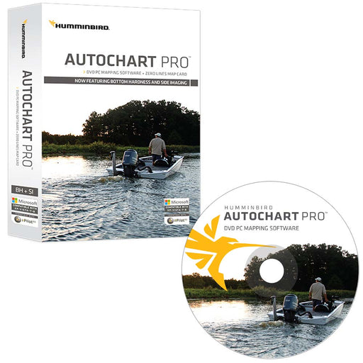
Humminbird AutoChart PRO DVD PC Mapping Software w/Zero Lines Map Card [600032-1]
Humminbird
Only 2 left!
AutoChart PRO™ DVD PC Mapping Software with Zero Lines Map CardAutoChart PRO™: Add another layer of detail to your cartography.Humminbird AutoChar...
View full details
Original price
$249.99
-
Original price
$249.99
Original price
$249.99
$249.99
-
$249.99
Current price
$249.99
Original price
$149.99
-
Original price
$149.99
Original price
$149.99
$149.99
-
$149.99
Current price
$149.99
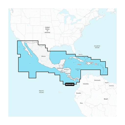
Garmin Navionics+ NSSA010R Central America Caribbean [010-C1451-20]
Garmin
Only 2 left!
Navionics+™ NSSA010R Central America & CaribbeanFeaturing vibrant colors, a streamlined interface, and combined coastal/inland content with a ...
View full details
Original price
$149.99
-
Original price
$149.99
Original price
$149.99
$149.99
-
$149.99
Current price
$149.99
Original price
$199.99
-
Original price
$199.99
Original price
$199.99
$199.99
-
$199.99
Current price
$199.99
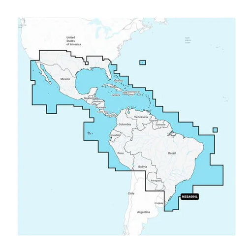
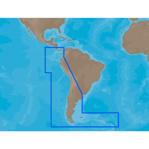
Garmin Navionics+ NSSA004L - Mexico, the Caribbean to Brazil - Inland Coastal Marine Chart [010-C1285-20]
Garmin
Only 1 left!
Navionics+™ NSSA004L - Mexico, the Caribbean to Brazil - Inland & Coastal Marine ChartGet the world’s No. 1 choice in the marine mapping with ...
View full details
Original price
$199.99
-
Original price
$199.99
Original price
$199.99
$199.99
-
$199.99
Current price
$199.99
Original price
$199.99
-
Original price
$199.99
Original price
$199.99
$199.99
-
$199.99
Current price
$199.99
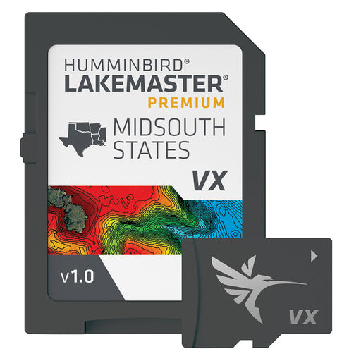
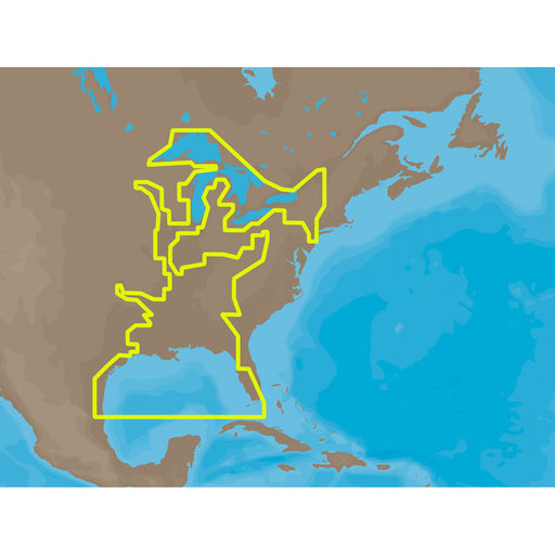
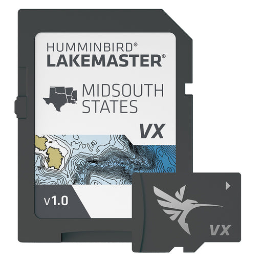
Humminbird LakeMaster VX Premium - Mid-South States [602005-1]
Humminbird
Only 3 left!
LakeMaster® VX Premium - Mid-South StatesAn upgraded premium mapping solution in Humminbird LakeMaster VX to help anglers understand what is under...
View full details
Original price
$199.99
-
Original price
$199.99
Original price
$199.99
$199.99
-
$199.99
Current price
$199.99
Original price
$149.99
-
Original price
$149.99
Original price
$149.99
$149.99
-
$149.99
Current price
$149.99
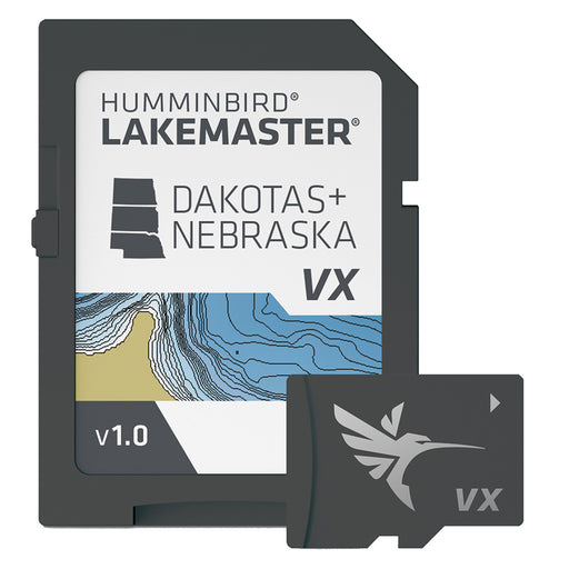
Humminbird LakeMaster VX - Dakotas/Nebraska [601001-1]
Humminbird
Only 3 left!
LakeMaster® VX - Dakotas/NebraskaAn upgraded mapping solution in Humminbird LakeMaster VX to help anglers understand what is under the water’s sur...
View full details
Original price
$149.99
-
Original price
$149.99
Original price
$149.99
$149.99
-
$149.99
Current price
$149.99
Original price
$149.99
-
Original price
$149.99
Original price
$149.99
$149.99
-
$149.99
Current price
$149.99
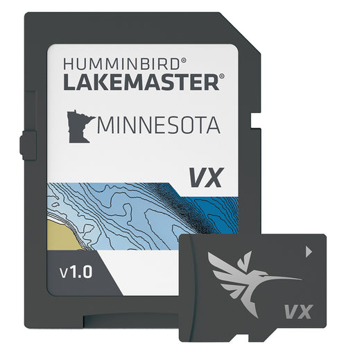
Humminbird LakeMaster VX - Minnesota [601006-1]
Humminbird
Only 3 left!
LakeMaster® VX - MinnesotaAn upgraded mapping solution in Humminbird LakeMaster VX to help anglers understand what is under the water’s surface be...
View full details
Original price
$149.99
-
Original price
$149.99
Original price
$149.99
$149.99
-
$149.99
Current price
$149.99
Original price
$149.99
-
Original price
$149.99
Original price
$149.99
$149.99
-
$149.99
Current price
$149.99
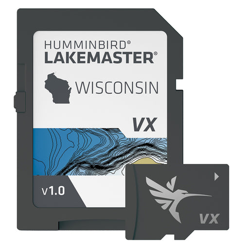
Humminbird LakeMaster VX - Wisconsin [601010-1]
Humminbird
Only 4 left!
LakeMaster® VX - WisconsinAn upgraded mapping solution in Humminbird LakeMaster VX to help anglers understand what is under the water’s surface be...
View full details
Original price
$149.99
-
Original price
$149.99
Original price
$149.99
$149.99
-
$149.99
Current price
$149.99
Original price
$0.00
-
Original price
$0.00
Original price
$0.00
$399.99
$399.99
-
$399.99
Current price
$399.99
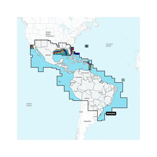
Garmin Navionics Vision+ NVSA004L -Mexico, the Caribbean to Brazil - Inland Coastal Marine Charts [010-C1285-00]
Garmin
Only 1 left!
Navionics Vision+™ NVSA004L - Mexico, the Caribbean to Brazil - Inland & Coastal Marine ChartsIt's A Whole New Look On Your ChartplotterFeatur...
View full details
Original price
$0.00
-
Original price
$0.00
Original price
$0.00
$399.99
$399.99
-
$399.99
Current price
$399.99
Original price
$149.99
-
Original price
$149.99
Original price
$149.99
$149.99
-
$149.99
Current price
$149.99
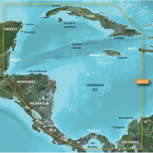
Garmin BlueChart g3 HD - HXUS031R - Southwest Caribbean - microSD/SD [010-C0732-20]
Garmin
Only 2 left!
BlueChart® g3 HD - HXUS031R - Southwest Caribbean - microSD™/SD™Coverage:Detailed coverage of the northern coast of Central America from Cancun, M...
View full details
Original price
$149.99
-
Original price
$149.99
Original price
$149.99
$149.99
-
$149.99
Current price
$149.99
Original price
$0.00
-
Original price
$0.00
Original price
$0.00
$260.00
$260.00
-
$260.00
Current price
$260.00
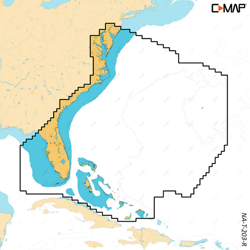
C-MAP REVEAL X - Chesapeake Bay to the Bahamas [M-NA-T-203-R-MS]
C-MAP
Only 1 left!
REVEAL™ X - Chesapeake Bay to the BahamasCOMPATIBILITY WITH SIMRAD NSX SERIES ONLYExperience the X Generation of C-MAP charts - with game-changing...
View full details
Original price
$0.00
-
Original price
$0.00
Original price
$0.00
$260.00
$260.00
-
$260.00
Current price
$260.00
Original price
$291.00
-
Original price
$291.00
Original price
$291.00
$291.00
-
$291.00
Current price
$291.00
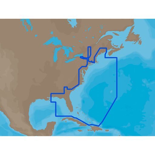
C-MAP MAX NA-M022 - U.S. East Coast & The Bahamas - SD Card [M-NA-M022-MS]
C-MAP
Only 5 left!
NA-M022 => USA East Coast and BahamasCoverage of the United States Atlantic coast from Passamaquoddy Bay, ME down to Key West, FL, with extende...
View full details
Original price
$291.00
-
Original price
$291.00
Original price
$291.00
$291.00
-
$291.00
Current price
$291.00
Original price
$291.00
-
Original price
$291.00
Original price
$291.00
$291.00
-
$291.00
Current price
$291.00
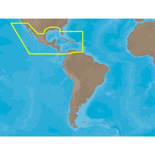
C-MAP MAX NA-M027 - Central America & The Caribbean - SD Card [NA-M027SDCARD]
C-MAP
Only 5 left!
NA-M027 => Central America and CaribbeanCoverage of Central America, all of the Caribbean and the northern coast of South America, and the Gulf...
View full details
Original price
$291.00
-
Original price
$291.00
Original price
$291.00
$291.00
-
$291.00
Current price
$291.00
Original price
$291.00
-
Original price
$291.00
Original price
$291.00
$291.00
-
$291.00
Current price
$291.00
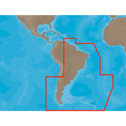
C-MAP MAX SA-M500 - Costa Rica-Chile Falklands - SD Card [SA-M500SDCARD]
C-MAP
Only 5 left!
SA-M500 => Costa Rica to Chile to FalklandsCoverage starts at Bahia de Salinas on Costa Rica's Pacific coast, and extends south and east along ...
View full details
Original price
$291.00
-
Original price
$291.00
Original price
$291.00
$291.00
-
$291.00
Current price
$291.00
Original price
$291.00
-
Original price
$291.00
Original price
$291.00
$291.00
-
$291.00
Current price
$291.00
C-MAP MAX NA-M023 - U.S. Gulf Coast & Inland Rivers - SD Card [NA-M023SDCARD]
C-MAP
Only 5 left!
NA-M023 => Gulf of Mexico, Great Lakes and RiversCoverage of the Gulf states, starting from Boca Raton, FL, down to Key West, FL, then back up ...
View full details
Original price
$291.00
-
Original price
$291.00
Original price
$291.00
$291.00
-
$291.00
Current price
$291.00
Original price
$291.00
-
Original price
$291.00
Original price
$291.00
$291.00
-
$291.00
Current price
$291.00
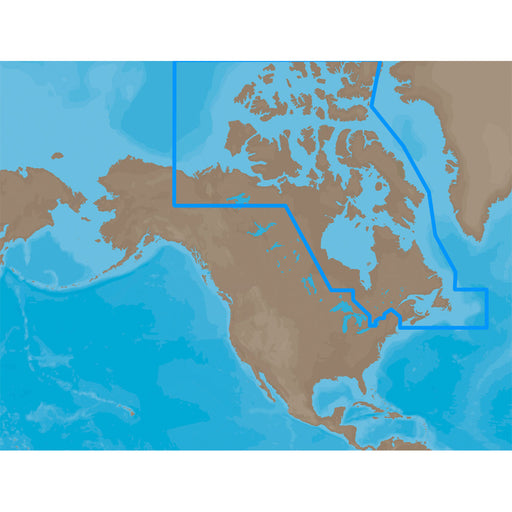
C-MAP MAX NA-M021 - Canada North & East - SD Card [NA-M021SDCARD]
C-MAP
Only 5 left!
NA-M021 => Canada North and EastCoverage of the Arctic and Atlantic coasts of Canada including Hudson Bay, Newfoundland, the Gulf of St. Lawren...
View full details
Original price
$291.00
-
Original price
$291.00
Original price
$291.00
$291.00
-
$291.00
Current price
$291.00
Original price
$291.00
-
Original price
$291.00
Original price
$291.00
$291.00
-
$291.00
Current price
$291.00
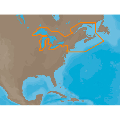
C-MAP MAX NA-M026 - Great Lakes & The Maritimes - SD Card [NA-M026SDCARD]
C-MAP
Only 5 left!
NA-M026 => Great Lakes, Northeast Coast and ApproachesCoverage of the Great Lakes, St. Lawrence River and Northeast United States. Coverage of...
View full details
Original price
$291.00
-
Original price
$291.00
Original price
$291.00
$291.00
-
$291.00
Current price
$291.00
Original price
$291.00
-
Original price
$291.00
Original price
$291.00
$291.00
-
$291.00
Current price
$291.00
C-MAP MAX SA-M501 - Gulf of Paria - Cape Horn - SD Card [SA-M501SDCARD]
C-MAP
Only 5 left!
SA-M501 => Gulf of Paria to Cape HornCoverage starts at Quintero, Chile on the Pacific coast and extends south down the Chile border, wraps up ...
View full details
Original price
$291.00
-
Original price
$291.00
Original price
$291.00
$291.00
-
$291.00
Current price
$291.00
Original price
$291.00
-
Original price
$291.00
Original price
$291.00
$291.00
-
$291.00
Current price
$291.00
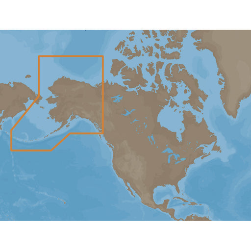
C-MAP MAX NA-M028 - Alaska - SD Card [NA-M028SDCARD]
C-MAP
Only 5 left!
NA-M028 => AlaskaCoverage of the southern Alaska coast from Dixon Entrance up and over to Kodiak Island. Includes all of the Aleutian Islands ...
View full details
Original price
$291.00
-
Original price
$291.00
Original price
$291.00
$291.00
-
$291.00
Current price
$291.00
Original price
$291.00
-
Original price
$291.00
Original price
$291.00
$291.00
-
$291.00
Current price
$291.00
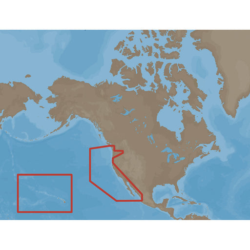
C-MAP MAX NA-M024 - U.S. West Coast & Hawaii - SD Card [NA-M024SDCARD]
C-MAP
Only 5 left!
NA-M024 => USA West Coast and HawaiiCoverage of the Pacific Coast of the United States, including all of the coasts of California, Oregon and W...
View full details
Original price
$291.00
-
Original price
$291.00
Original price
$291.00
$291.00
-
$291.00
Current price
$291.00
Original price
$291.00
-
Original price
$291.00
Original price
$291.00
$291.00
-
$291.00
Current price
$291.00
C-MAP MAX NA-M025 - Canada West - SD Card [NA-M025SDCARD]
C-MAP
Only 5 left!
NA-M025 => Canada WestCoverage of British Columbia, Puget Sound and the San Juan Islands. Full coverage of Vancouver Island and the Queen Char...
View full details
Original price
$291.00
-
Original price
$291.00
Original price
$291.00
$291.00
-
$291.00
Current price
$291.00
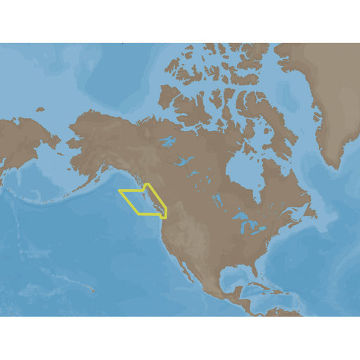
Original price
$349.99
-
Original price
$349.99
Original price
$349.99
$349.99
-
$349.99
Current price
$349.99
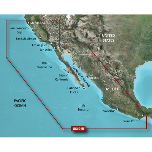
Garmin BlueChart g3 Vision HD - VUS021R - California-Mexico - microSD/SD [010-C0722-00]
Garmin
Only 1 left!
BlueChart® g3 Vision® HD - VUS021R - California - Mexico - microSD™/SD™Coverage:Point Arena to Puerto Vallarta, including Mendocino, San Francisco...
View full details
Original price
$349.99
-
Original price
$349.99
Original price
$349.99
$349.99
-
$349.99
Current price
$349.99
Original price
$199.99
-
Original price
$199.99
Original price
$199.99
$199.99
-
$199.99
Current price
$199.99
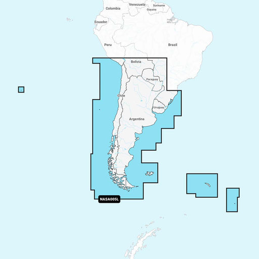
Navionics NASA005L - Chile, Argentina Easter Island - Navionics+ [010-C1365-30]
Navionics
Only 4 left!
NASA005L - Chile, Argentina & Easter Island - Navionics+Get the world’s No. 1 choice in marine mapping - with the best, most up-to-date Navion...
View full details
Original price
$199.99
-
Original price
$199.99
Original price
$199.99
$199.99
-
$199.99
Current price
$199.99
Original price
$149.99
-
Original price
$149.99
Original price
$149.99
$149.99
-
$149.99
Current price
$149.99
Humminbird LakeMaster VX - Mid-South States [601005-1]
Humminbird
Only 3 left!
LakeMaster® VX - Mid-South StatesAn upgraded mapping solution in Humminbird LakeMaster VX to help anglers understand what is under the water’s sur...
View full details
Original price
$149.99
-
Original price
$149.99
Original price
$149.99
$149.99
-
$149.99
Current price
$149.99
Original price
$149.99
-
Original price
$149.99
Original price
$149.99
$149.99
-
$149.99
Current price
$149.99
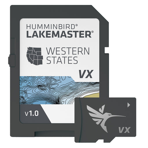
Humminbird LakeMaster VX - Western States [601009-1]
Humminbird
Only 4 left!
LakeMaster® VX - Western StatesAn upgraded mapping solution in Humminbird LakeMaster VX to help anglers understand what is under the water’s surfa...
View full details
Original price
$149.99
-
Original price
$149.99
Original price
$149.99
$149.99
-
$149.99
Current price
$149.99