
Products
Original price
$291.00
-
Original price
$291.00
Original price
$291.00
$291.00
-
$291.00
Current price
$291.00
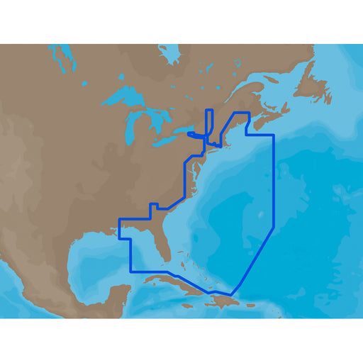
C-MAP MAX NA-M022 - U.S. East Coast & The Bahamas - SD Card [M-NA-M022-MS]
C-MAP
Only 5 left!
NA-M022 => USA East Coast and BahamasCoverage of the United States Atlantic coast from Passamaquoddy Bay, ME down to Key West, FL, with extende...
View full details
Original price
$291.00
-
Original price
$291.00
Original price
$291.00
$291.00
-
$291.00
Current price
$291.00
Original price
$291.00
-
Original price
$291.00
Original price
$291.00
$291.00
-
$291.00
Current price
$291.00
C-MAP MAX NA-M023 - U.S. Gulf Coast & Inland Rivers - SD Card [NA-M023SDCARD]
C-MAP
Only 5 left!
NA-M023 => Gulf of Mexico, Great Lakes and RiversCoverage of the Gulf states, starting from Boca Raton, FL, down to Key West, FL, then back up ...
View full details
Original price
$291.00
-
Original price
$291.00
Original price
$291.00
$291.00
-
$291.00
Current price
$291.00
Original price
$291.00
-
Original price
$291.00
Original price
$291.00
$291.00
-
$291.00
Current price
$291.00
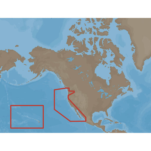
C-MAP MAX NA-M024 - U.S. West Coast & Hawaii - SD Card [NA-M024SDCARD]
C-MAP
Only 5 left!
NA-M024 => USA West Coast and HawaiiCoverage of the Pacific Coast of the United States, including all of the coasts of California, Oregon and W...
View full details
Original price
$291.00
-
Original price
$291.00
Original price
$291.00
$291.00
-
$291.00
Current price
$291.00
Original price
$291.00
-
Original price
$291.00
Original price
$291.00
$291.00
-
$291.00
Current price
$291.00
C-MAP MAX NA-M025 - Canada West - SD Card [NA-M025SDCARD]
C-MAP
Only 5 left!
NA-M025 => Canada WestCoverage of British Columbia, Puget Sound and the San Juan Islands. Full coverage of Vancouver Island and the Queen Char...
View full details
Original price
$291.00
-
Original price
$291.00
Original price
$291.00
$291.00
-
$291.00
Current price
$291.00
Original price
$291.00
-
Original price
$291.00
Original price
$291.00
$291.00
-
$291.00
Current price
$291.00
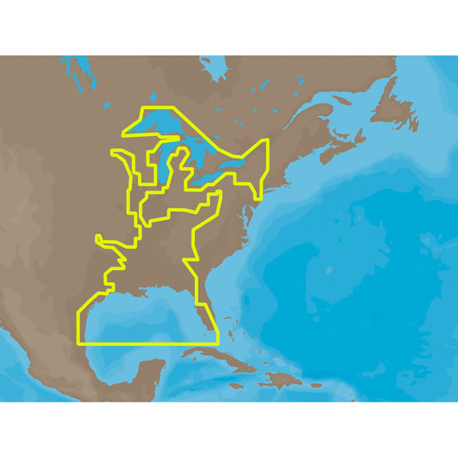
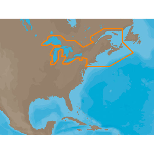
C-MAP MAX NA-M026 - Great Lakes & The Maritimes - SD Card [NA-M026SDCARD]
C-MAP
Only 5 left!
NA-M026 => Great Lakes, Northeast Coast and ApproachesCoverage of the Great Lakes, St. Lawrence River and Northeast United States. Coverage of...
View full details
Original price
$291.00
-
Original price
$291.00
Original price
$291.00
$291.00
-
$291.00
Current price
$291.00
Original price
$291.00
-
Original price
$291.00
Original price
$291.00
$291.00
-
$291.00
Current price
$291.00
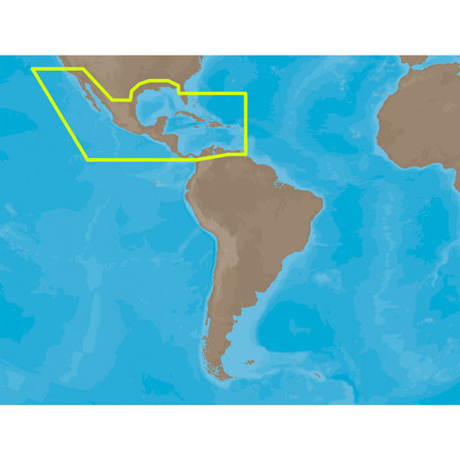
C-MAP MAX NA-M027 - Central America & The Caribbean - SD Card [NA-M027SDCARD]
C-MAP
Only 5 left!
NA-M027 => Central America and CaribbeanCoverage of Central America, all of the Caribbean and the northern coast of South America, and the Gulf...
View full details
Original price
$291.00
-
Original price
$291.00
Original price
$291.00
$291.00
-
$291.00
Current price
$291.00
Original price
$291.00
-
Original price
$291.00
Original price
$291.00
$291.00
-
$291.00
Current price
$291.00
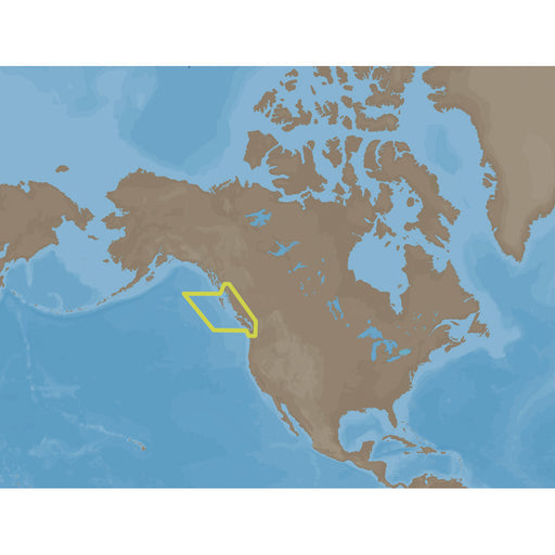
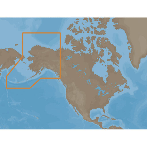
C-MAP MAX NA-M028 - Alaska - SD Card [NA-M028SDCARD]
C-MAP
Only 5 left!
NA-M028 => AlaskaCoverage of the southern Alaska coast from Dixon Entrance up and over to Kodiak Island. Includes all of the Aleutian Islands ...
View full details
Original price
$291.00
-
Original price
$291.00
Original price
$291.00
$291.00
-
$291.00
Current price
$291.00
Original price
$291.00
-
Original price
$291.00
Original price
$291.00
$291.00
-
$291.00
Current price
$291.00
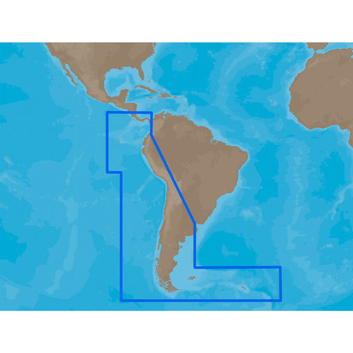
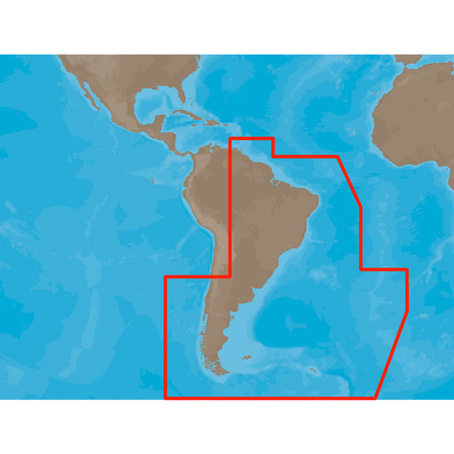
C-MAP MAX SA-M500 - Costa Rica-Chile Falklands - SD Card [SA-M500SDCARD]
C-MAP
Only 5 left!
SA-M500 => Costa Rica to Chile to FalklandsCoverage starts at Bahia de Salinas on Costa Rica's Pacific coast, and extends south and east along ...
View full details
Original price
$291.00
-
Original price
$291.00
Original price
$291.00
$291.00
-
$291.00
Current price
$291.00
Original price
$291.00
-
Original price
$291.00
Original price
$291.00
$291.00
-
$291.00
Current price
$291.00
C-MAP MAX SA-M501 - Gulf of Paria - Cape Horn - SD Card [SA-M501SDCARD]
C-MAP
Only 5 left!
SA-M501 => Gulf of Paria to Cape HornCoverage starts at Quintero, Chile on the Pacific coast and extends south down the Chile border, wraps up ...
View full details
Original price
$291.00
-
Original price
$291.00
Original price
$291.00
$291.00
-
$291.00
Current price
$291.00
Original price
$0.00
-
Original price
$0.00
Original price
$0.00
$260.00
$260.00
-
$260.00
Current price
$260.00
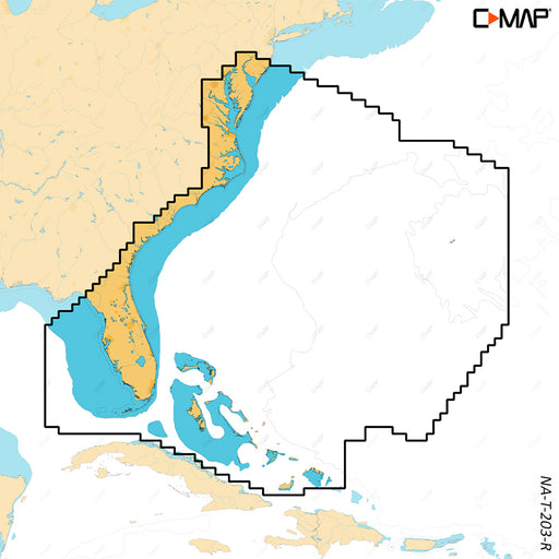
C-MAP REVEAL X - Chesapeake Bay to the Bahamas [M-NA-T-203-R-MS]
C-MAP
Only 1 left!
REVEAL™ X - Chesapeake Bay to the BahamasCOMPATIBILITY WITH SIMRAD NSX SERIES ONLYExperience the X Generation of C-MAP charts - with game-changing...
View full details
Original price
$0.00
-
Original price
$0.00
Original price
$0.00
$260.00
$260.00
-
$260.00
Current price
$260.00
Original price
$177.00
-
Original price
$177.00
Original price
$177.00
$177.00
-
$177.00
Current price
$177.00
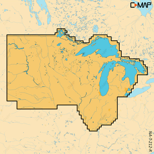
C-MAP REVEAL X - U.S. Lakes North Central [M-NA-T-212-R-MS]
C-MAP
Only 3 left!
REVEAL™ X - U.S. Lakes North CentralCOMPATIBILITY WITH SIMRAD NSX SERIES ONLYExperience the X Generation of C-MAP charts - with game-changing Shad...
View full details
Original price
$177.00
-
Original price
$177.00
Original price
$177.00
$177.00
-
$177.00
Current price
$177.00
Original price
$74.99
-
Original price
$74.99
Original price
$74.99
$74.99
-
$74.99
Current price
$74.99
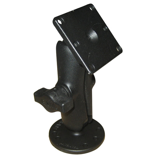
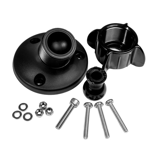
FLIR AX8 Ball & Socket Mount [261-2319-00]
FLIR Systems
in stock
AX8™ Ball & Socket MountOptional FLIR Ball and Socket Mount for FLIR's AX8™ and Pathfinder ii
Original price
$74.99
-
Original price
$74.99
Original price
$74.99
$74.99
-
$74.99
Current price
$74.99
Original price
$84.99
-
Original price
$84.99
Original price
$84.99
$84.99
-
$84.99
Current price
$84.99
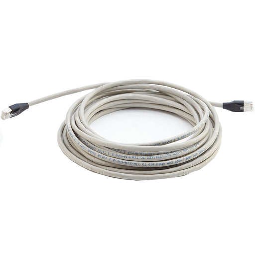
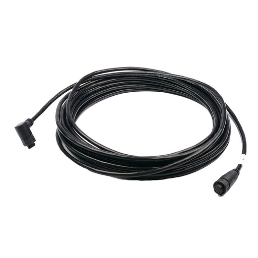
FLIR Ethernet Cable f/M-Series - 25' [308-0163-25]
FLIR Systems
Only 3 left!
Ethernet Cable for M-Series - 25'FLIR's 25' Ethernet Cable is for connecting the FLIR M-Series Cameras tothe Joystick Control Unit.Features: Doubl...
View full details
Original price
$84.99
-
Original price
$84.99
Original price
$84.99
$84.99
-
$84.99
Current price
$84.99
Original price
$44.99
-
Original price
$44.99
Original price
$44.99
$44.99
-
$44.99
Current price
$44.99
FLIR Free Standing Mount [R70375]
FLIR Systems
in stock
Free Standing MountFLIR Free Standing Mount for FLIR's AX8™ and Raymarine Dragonfly 4/5/7.
Original price
$44.99
-
Original price
$44.99
Original price
$44.99
$44.99
-
$44.99
Current price
$44.99
Original price
$211.99
-
Original price
$211.99
Original price
$211.99
$211.99
-
$211.99
Current price
$211.99
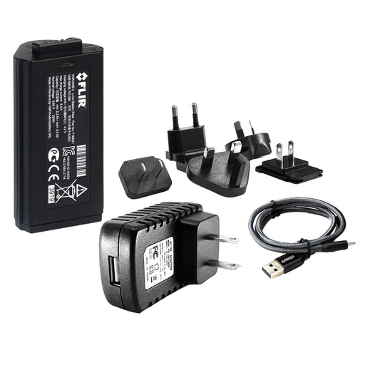
FLIR GPX310 Scion Rechargeable Battery Kit [7GX-03-F010]
FLIR Systems
in stock
GPX310 Scion Rechargeable Battery Kit Allows you to operate the Scion thermal imaging monoculars for up to 10 hours, and its high-capacity 8.5 Ah ...
View full details
Original price
$211.99
-
Original price
$211.99
Original price
$211.99
$211.99
-
$211.99
Current price
$211.99
Original price
$1,799.99
-
Original price
$1,799.99
Original price
$1,799.99
$1,799.99
-
$1,799.99
Current price
$1,799.99
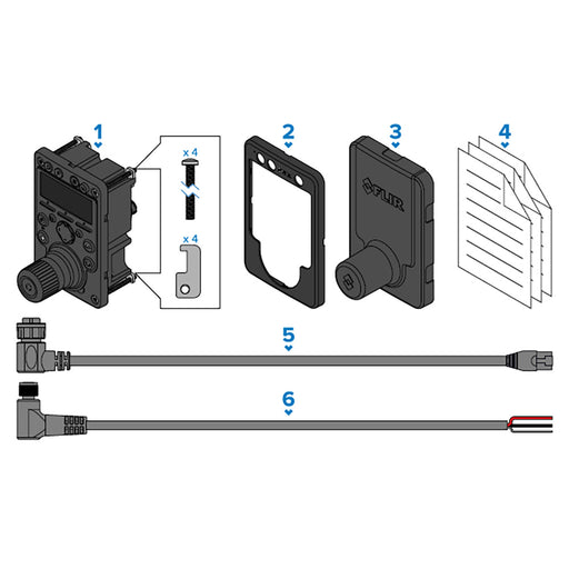
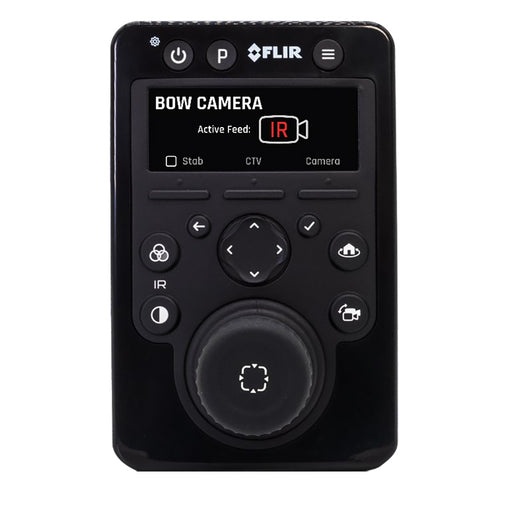
FLIR JCU-4 Premium Joystick Control Unit [E70695]
FLIR Systems
Only 2 left!
JCU-4 Premium Joystick Control UnitThe JCU-4 provides pan, tilt, zoom, and confident control of all camera functions. It is our premier joystick c...
View full details
Original price
$1,799.99
-
Original price
$1,799.99
Original price
$1,799.99
$1,799.99
-
$1,799.99
Current price
$1,799.99
Original price
$509.99
-
Original price
$509.99
Original price
$509.99
$509.99
-
$509.99
Current price
$509.99
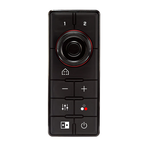
FLIR JCU3 Compact Joystick f/M100/200 - Raymarine RayNet Network [A80510]
FLIR Systems
Only 4 left!
JCU3 Compact Joystick for M100/200 - Raymarine RayNet NetworkFLIR’s JCU-3 Joystick Controller works with select Thermal Camera Systems to allow fu...
View full details
Original price
$509.99
-
Original price
$509.99
Original price
$509.99
$509.99
-
$509.99
Current price
$509.99
Original price
$0.00
-
Original price
$0.00
Original price
$0.00
$3,095.00
$3,095.00
-
$3,095.00
Current price
$3,095.00
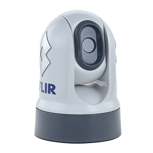
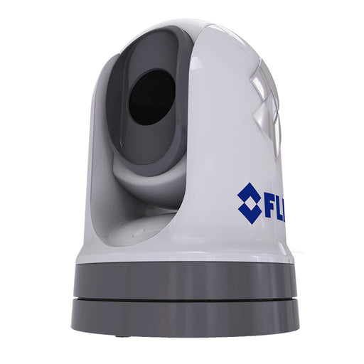
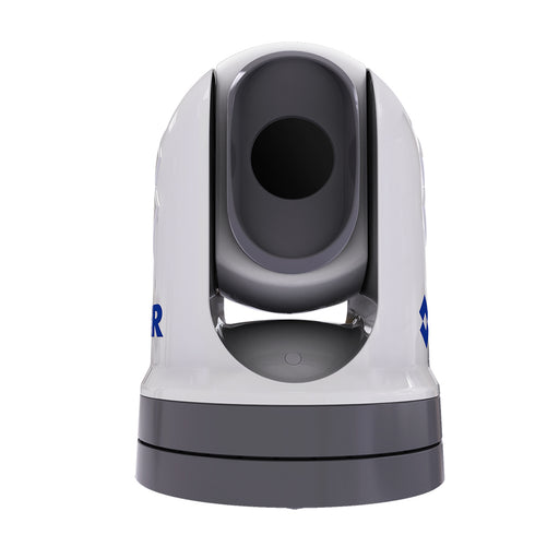
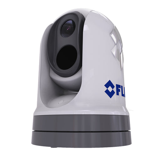
FLIR M232 Pan/Tilt 9Hz Marine Thermal Camera [E70354]
FLIR Systems
in stock
M232 Pan/Tilt 9Hz Marine Thermal CameraThe FLIR M232 marine thermal camera is the smallest and most affordable pan and tilt marine thermal night v...
View full details
Original price
$0.00
-
Original price
$0.00
Original price
$0.00
$3,095.00
$3,095.00
-
$3,095.00
Current price
$3,095.00
Original price
$94.99
-
Original price
$94.99
Original price
$94.99
$94.99
-
$94.99
Current price
$94.99
FLIR M300 RayNet Right Angle to Straight Cable - 3M [A80695]
FLIR Systems
in stock
M300 RayNet Right Angle to Straight Cable - 3MRayNet is a waterproof Ethernet cabling system developed by Raymarine, ideal for marine environments...
View full details
Original price
$94.99
-
Original price
$94.99
Original price
$94.99
$94.99
-
$94.99
Current price
$94.99
Original price
$7,695.00
-
Original price
$7,695.00
Original price
$7,695.00
$7,695.00
-
$7,695.00
Current price
$7,695.00
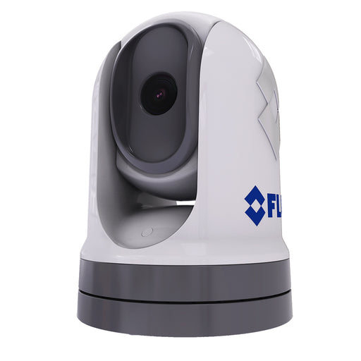
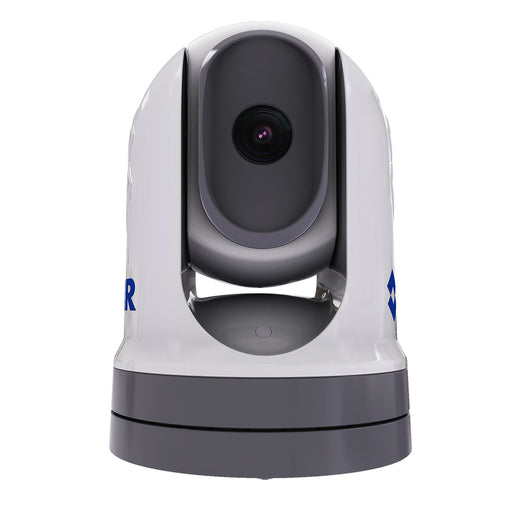
FLIR M300C Stabilized Visible IP Camera [E70605]
FLIR Systems
Only 5 left!
M300C Stabilzed Visible IP CameraCombining a high-performance visible marine camera with long-range optical zoom capability, the M300C offe...
View full details
Original price
$7,695.00
-
Original price
$7,695.00
Original price
$7,695.00
$7,695.00
-
$7,695.00
Current price
$7,695.00
Original price
$8,795.00
-
Original price
$8,795.00
Original price
$8,795.00
$8,795.00
-
$8,795.00
Current price
$8,795.00
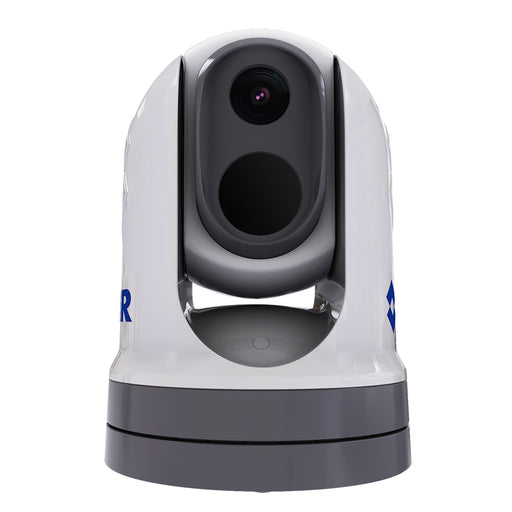
FLIR M332 Stabilized Thermal IP Camera [E70527]
FLIR Systems
in stock
M332 Stabilized Thermal IP CameraPairing a rugged, all-weather design with one of the most advanced FLIR thermal imaging cores, the M332 deliver a...
View full details
Original price
$8,795.00
-
Original price
$8,795.00
Original price
$8,795.00
$8,795.00
-
$8,795.00
Current price
$8,795.00
Original price
$34,995.00
-
Original price
$34,995.00
Original price
$34,995.00
$34,995.00
-
$34,995.00
Current price
$34,995.00
FLIR M364C LR Stabilized Thermal/Visible Long Range IP Camera [E70520]
FLIR Systems
Only 4 left!
M364C LR Stabilzed Thermal/Visible Long Range IP CameraPREMIUM MULTISPECTRAL MARINE CAMERAS WITH ACTIVE GYRO-STABILIZATIONFeaturing a high definit...
View full details
Original price
$34,995.00
-
Original price
$34,995.00
Original price
$34,995.00
$34,995.00
-
$34,995.00
Current price
$34,995.00


Original price
$24,495.00
-
Original price
$24,495.00
Original price
$24,495.00
$24,495.00
-
$24,495.00
Current price
$24,495.00
FLIR M364C Stabilized Thermal Visible IP Camera [E70518]
FLIR Systems
in stock
M364C Stabilized Thermal IP CameraPREMIUM MULTISPECTRAL MARINE CAMERAS WITH ACTIVE GYRO-STABILIZATIONFeaturing a high-definition low light camera ...
View full details
Original price
$24,495.00
-
Original price
$24,495.00
Original price
$24,495.00
$24,495.00
-
$24,495.00
Current price
$24,495.00
Original price
$1,359.99
-
Original price
$1,359.99
Original price
$1,359.99
$1,359.99
-
$1,359.99
Current price
$1,359.99
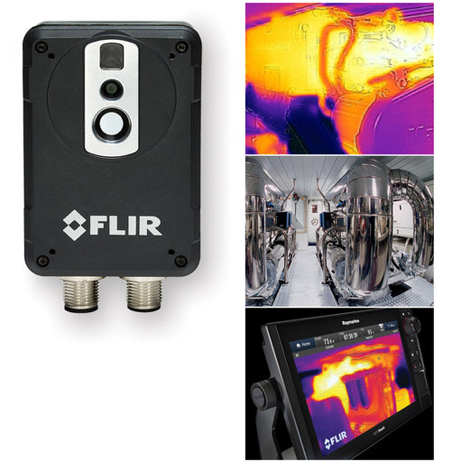
FLIR MTMS Maritime Thermal Monitoring System [E70321]
FLIR Systems
Only 1 left!
MTMS Marine Thermal Monitoring System - Formally called AX8Gain an entirely new view of your vessel's mechanical system with the FLIR AX8 thermal ...
View full details
Original price
$1,359.99
-
Original price
$1,359.99
Original price
$1,359.99
$1,359.99
-
$1,359.99
Current price
$1,359.99